Goals of the Project

Agricultural lands are intensively managed for high crop productivity. In the US Midwest, this is achieved through fertilizer application on a land that is significantly modified through tillage, and tile installation and channelization to increase the drainage in low relief topography. This process allows for agricultural machinery to be deployed in the field in a timely fashion in the spring, and support high crop productivity through the growing season. However, over time these same processes dislocate soil and carbon that is important to soil health, and transport excess nitrogen into waterways resulting in hypoxia in the gulf and other water bodies.

This CINet project hones in on the role of “Critical Interfaces” that play a dominant role in overall functioning of the landscape resulting from the intertwined of hydrological, biological, ecological, geological, and chemical processes. These interfaces, which can be natural (e.g., depressions, floodplains) or human made (e.g., tile network, riparian buffers), can enhance or reduce landscape connectivity and serve as sites of interaction, amplification or dampening, and integration of material fluxes.

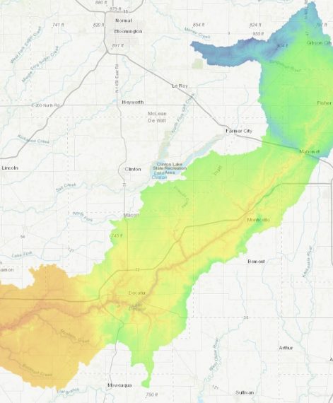
Through utilizing a network of observational sites across the US Midwest that capture gradients of climate, topography, geologic history, and other landscape settings, the CINet project will provide a comprehensive understanding of how various components of a landscape serve to provide an integrated response. As a result, this research will provide unprecedented predictive capability for agro-ecosystems in relation to changes and impact of management and weather with implications for soil health and nutrient management.

Core Sites Located in the Upper Sangamon River Watershed

There are seven core or main sites located throughout the Upper Sangamon River Watershed. This watershed is pictured to the right. Each site is highlighted below.

Want to learn more? Head to our website https://cinet.ncsa.illinois.ed...

Upper Sangamon River Watershed

Upper Sangamon River Watershed

Riverlab Location

Riverlab Location

Site One

Site One

Why the Sangamon River Watershed?

The Sangamon River was chosen because it lies in the glaciated parts of the Midwest and outer reaches of the upper Mississippi River Basin. These regions contain some of the most productive, but intensively managed landscapes (agricultural fields) in the world.

In 2007, the land which was formerly cultivated for over 70 year, was reseeded back to a native prairie. This site is an important location because it gives us an idea of how water, weather, and the different soil properties behave in a relatively native landscape.

This site has a weather monitoring system that started operating in 2014. The system measures many different weather characteristics including temperature, relative humidity, atmospheric pressure, and precipitation using rain gauge.

There are also soil moisture probes that are installed at depths of 5cm, 20cm, and 60cm in 4 different locations around the site.

Lastly, this site contains groundwater measuring wells. The deepest well reaches a depth of around 100 meters (98 feet). This deep well monitors the groundwater levels in regional aquifers, one in particular is the Mahomet aquifer. There are also shallow wells that measure seasonal changes in the near surface water table.

The flux tower measures the interaction between the soil, land, and atmosphere.

The different elements being measured include wind speed, temperature, soil moisture and ecosystem changes with water, carbon, and temperature.

The measurements are taken at different levels including 25 meters, 10 meters, ground level and below ground. This is important because at each level there are different readings taking place. At 25 meters wind speed and atmospheric stability are being measured. At 10 meters, solar radiation, air temperature, relative humidity, and wind speed. At the ground level, there is a rain gauge measuring rainfall, ambient temperature, and ambient pressure.

The measurements being collected below ground include soil moisture, electrical conductivity, and soil temperature. The depths of these measurements are at depths ranging from 5 cm to 180 cm.

This site provides an ideal location for many different comparative measurements. The landscape is interconnected, from the agricultural field to Goose Creek, as well as having a vast tile drainage system. The site is great for comparative study of SOC (soil organic carbon) variability as well as hydropedological (water and soil) processes. This site also holds potential as an important contrast with MIRZ (management-induced reactive zone) sites, the hillslope transect, and floodplain depocenters, and a possible input end for the RiverLab (learn more at Site 7).

There are two stream gauging stations with ISCO automatic water samplers on Goose Creek. The upstream site is near the transition between the flat, intensive agriculture terrain and steeper Sangamon River valley. The downstream site is near the bottom of the valley just upstream of the Goose Creek-Sangamon River confluence.

Streamflow is measured every 15 minutes and the ISCO equipment uses the streamflow data to sample water at predetermined frequencies. These sites allow researchers to understand changes in sediment fluxes between the different terrain and channel characteristics. In addition, sediment in water samples will undergo additional analyses.

This site is along a tributary of the Sangamon river. The site was originally established to measure water and sediment changes in the stream from the tile drains throughout the field.

This research has been going on for many years and researchers now have a better understanding of the carbon cycle as well as nutrient loss through tile drain flow. The site also has weather and soil sensors. The data being collected from the weather station includes relative humidity, temperature, air pressure, rainfall amounts, and wind monitoring.

The soil sensors are placed at 5cm, 20cm, and 60cm to measure soil moisture, temperature, and electrical conductivity. For the current CINet project there will also be an MIRZ (management-induced reactive zone) system that will measure soil gas and moisture levels automatically every hour, as well as soil organic matter chemistry collected by a researcher bi-weekly.

This site will be utilized for one-time deep core soil characterizations which will extend across the floodplain. The goal of this coring is to provide a reference of soil organic matter levels and any longer-term processes, such as weathering or net deposition. Many of the cores will reach depths of about 6 meters to get an entire record of sedimentation and erosion.

This site hosts a state of the art technology that will be complemented by the work being done at the other six sites. This site will help researchers understand how different characteristics in the floodplain influence storm surge signals.

The RiverLab will take in-stream measurements of pH, turbidity (cloudiness of the water), temperature, conductivity, oxygen and total organic carbon concentrations at 10 second intervals, just to name a few of the tests being conducted. This will be the first measuring system of its kind in North America.

Hypothesis & Objectives

Critical zone dynamics in intensively managed landscapes (IMLs) do not operate uniformly over time and space. They are intermittent and concentrated at critical interfaces (CIs) of exceptional importance for regulating material (i.e., water, sediment, carbon and nutrients) storage, transport and transformations.

The central hypothesis of our research is that the dynamics of critical interfaces exert disproportionately large control on the overall dynamics of critical zones at the landscape scale; and since these critical interfaces are undergoing rapid and co-evolutionary transition due to human and weather stressors across spatial and temporal scales, they constitute the most limiting elements for predictive understanding to guide sustainable management of IMLs.

The objective of the proposed research is to advance our understanding of critical interfaces individually as well as their interdependencies to overcome predictability bottlenecks of hydrobiogeochemical phenomena and their trajectories in IMLs from the small scale to the landscape scale, and from the event time scale to seasonal, inter-annual and decadal time scales. We will systematically look at the structure, evolution, and functioning of three interfaces that are particularly relevant to critical zone strongly affected by human action and weather: (i) the near land-surface; (ii) the active root zone; and (iii) the river corridor.